Five Peaks Challenge event details
Event Day
Event day Sunday 11 April 2027
At-the-start registration open 6:30 am
Longer ride starts 7:30 am
Shorter ride starts 8:00 am
Rider Pack
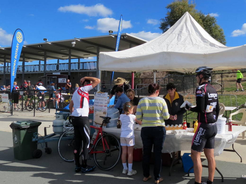
Collect at Stromlo Forest Park
Saturday 2 pm to 4 pm
Sunday from 6:30 am until the start
Rider pack contains: cycle rider card, route map, route cue sheet & rider instructions
A Personal Challenge
You can choose which peaks not to climb by simpily by-passing them.
All pedal cycles welcome including electric assist e-bikes
If you bypass all peaks the distances are 80 km (longer ride) and 57 km (shorter ride).
All money raised goes to
selected charities
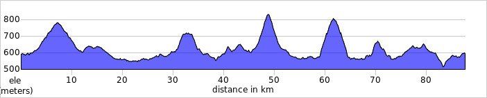
Shorter ride
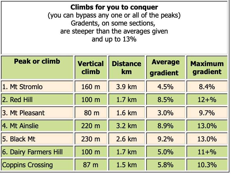
For 2026, it's 83 km with 1,370 m vertical climbing
Start at Stromlo Forest Park 603 m AMSL
Peak 1 - Mt. Stromlo 782 m AMSL
Peak 2 - Red Hill 720 m AMSL
Peak 3 - Mt Pleasant 663 m AMSL
Peak 4 - Mt Ainslie 843 m AMSL
Peak 5 - Black Mt 812 m AMSL
Peak 6 - Dairy Famers Hill 673 m AMSL
Ride back to Stromlo Forest Park 603 m AMSL
(heights above seal level - climb details below)
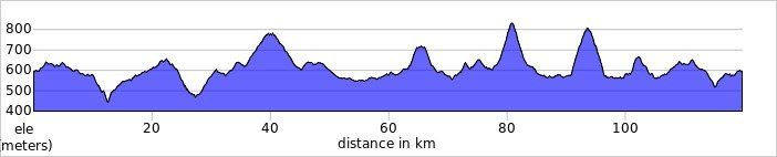
Longer ride Plus ride
For 2026, it's 113 km with 1,820 m vertical climbing
Start at Stromlo Forest Park 603 m
Complete the Uriarra Loop - before joining the shorter course
Peak 1 - Mt. Stromlo 782 m AMSL
Peak 2 - Red Hill 720 m AMSL
Peak 3 - Mt Pleasant 663 m AMSL
Peak 4 - Mt Ainslie 843 m AMSL
Peak 5 - Black Mt 812 m AMSL
Peak 6 - Dairy Famers Hill 673 m AMSL
Ride back to Stromlo Forest Park 603 m AMSL
(heights above sea level - climb details below)
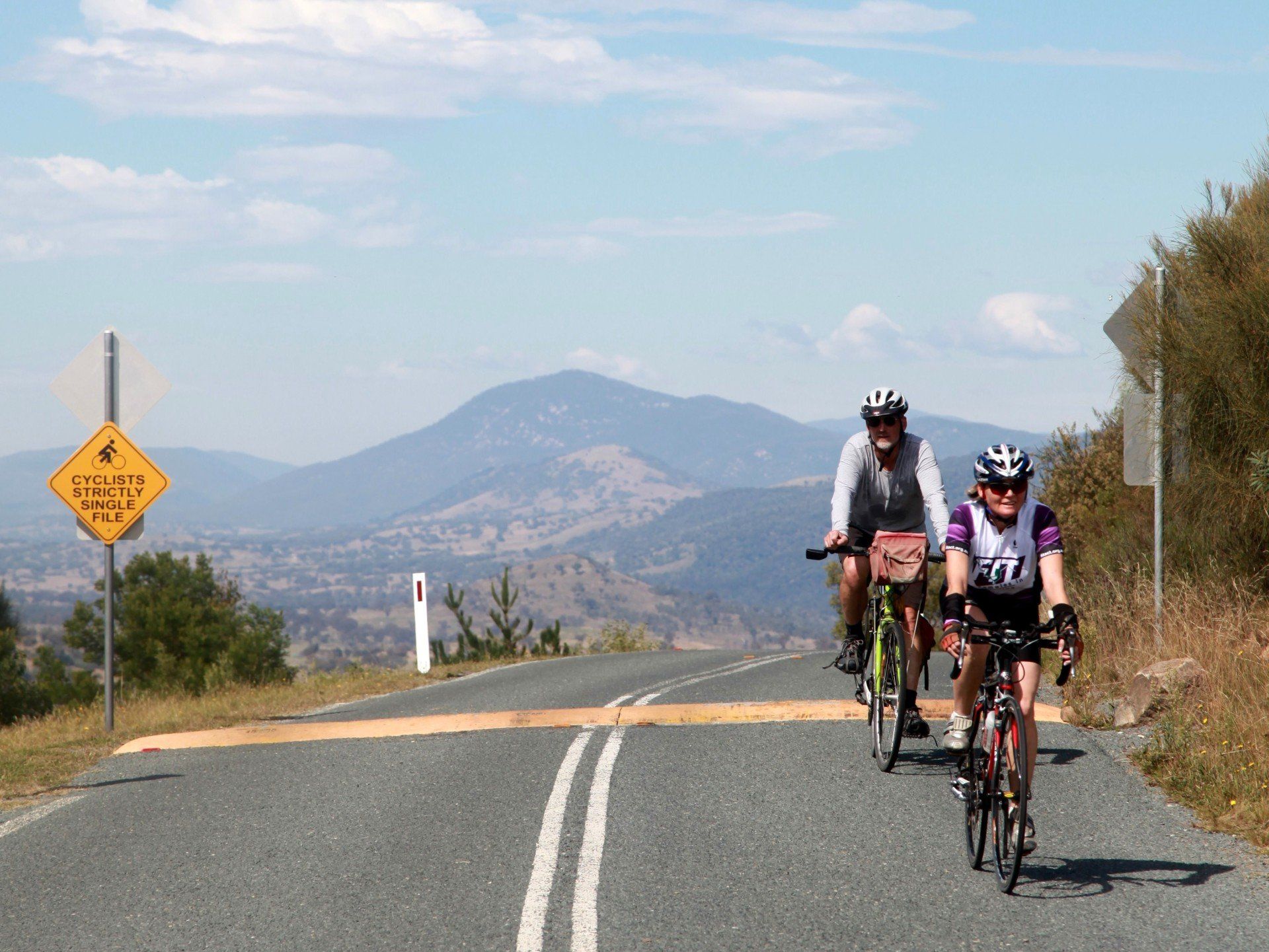
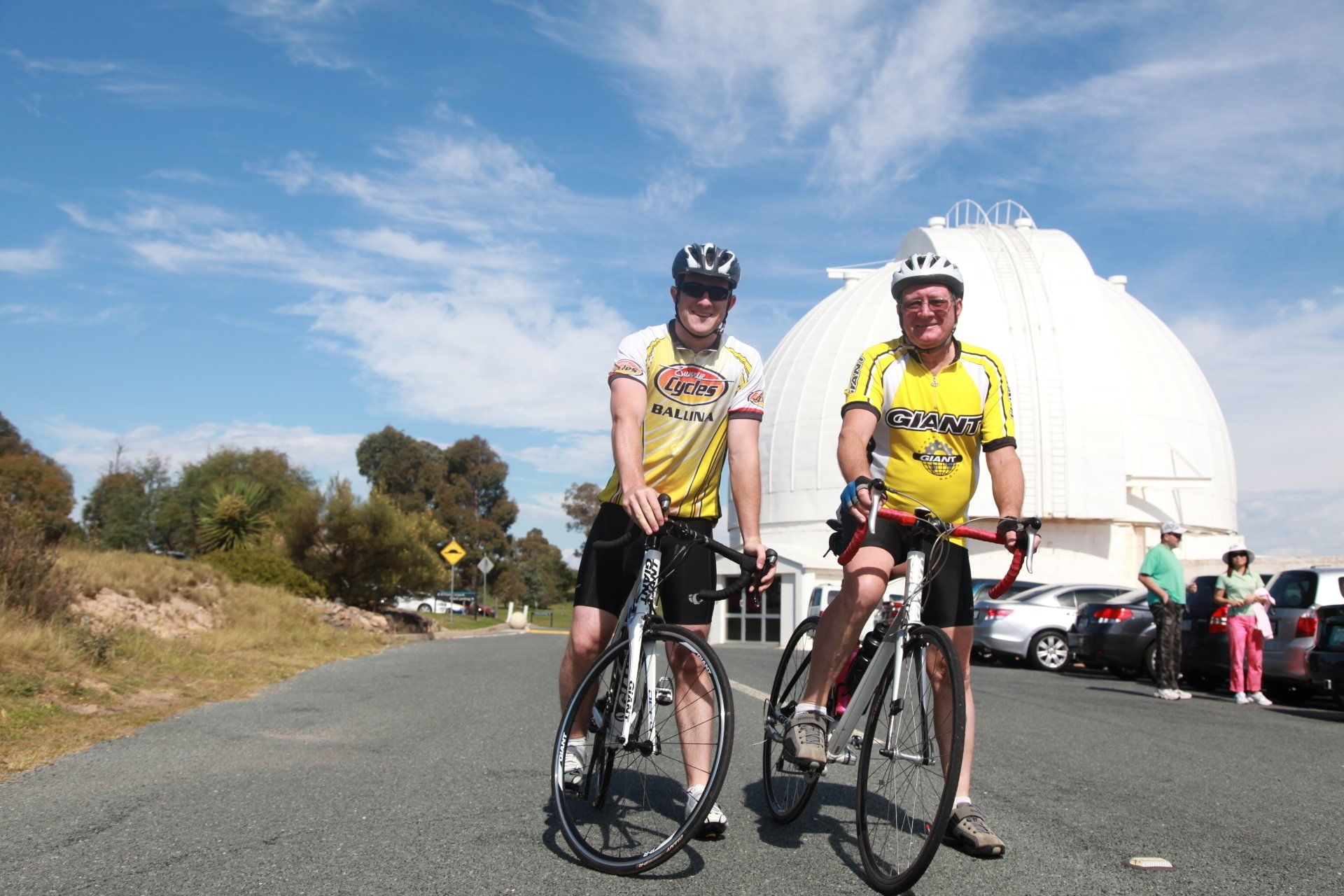
- One of Canberra's most iconic bike rides
- See Canberra from the saddle
- Six peaks, in 83 km or 113 km
- Plus the other undulations on the course
Are you up for it?
Six Peaks in one day - 1,370 m total vertical climbing in 83 km or 1,820 m in 113 km.
Ride to the top of as many peaks as you choose - it's up to you.
Your non-climbing buddy can by-pass them all and ride 80 km (longer route) or 57 km (shorter route).
Make realistic choices when taking on the challenge. Be part of it.
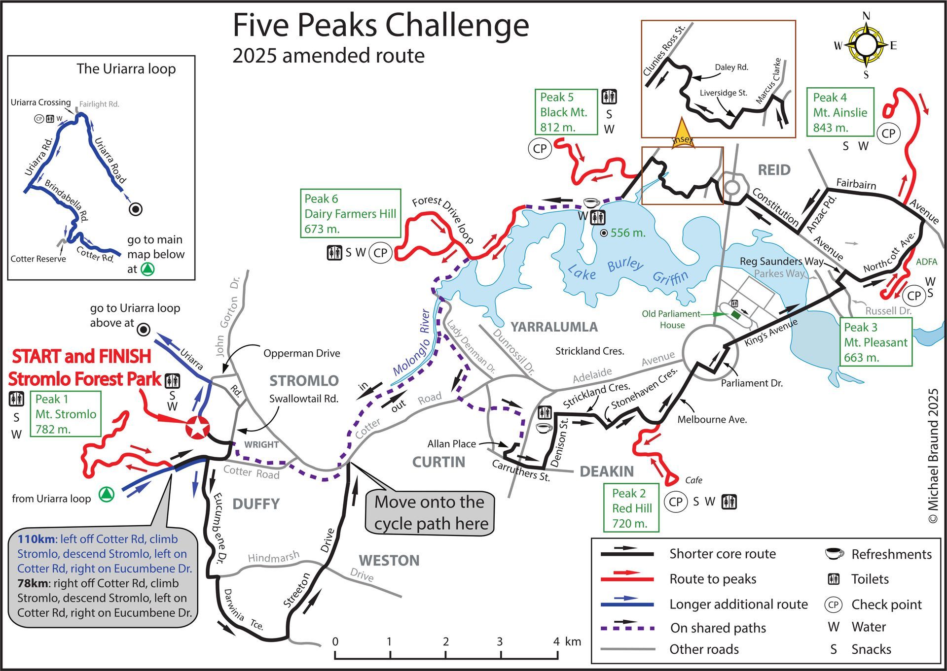
COURSE INFO
The courses will be marked with yellow arrows on the road or path surface and there will be volunteers stationed along the course to offer guidance and encouragement.
CHECKPOINTS
Checkpoints are at the top of each peak and at the refreshment stations at The Royal Australian Mint and Black Mountain Peninsular (shown on route map). Your rider card will be marked at the checkpoints and the finish as a record to show your achievement.

Course routes and profiles shown.
GPX or TCX files for downloading:
> View a course, click on
More and
Export as File from the left hand menu.
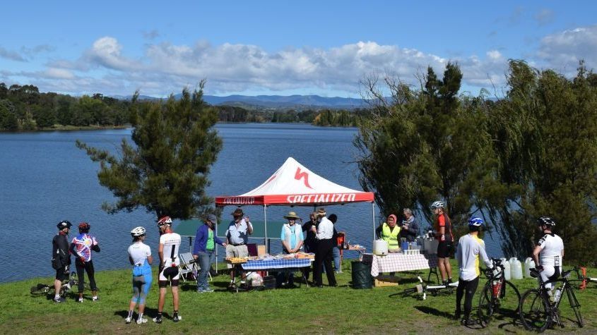
REFRESHMENT STATIONS
Refreshment stations are well stocked with cakes, biscuits, fruit, lollies and water for a gastronomical delight at (shown on route map):
- The Royal Australian Mint (with coffee van in attendance)
- On the path near the entrance to Black Mountain Peninsular, Garryowen Drive just off Lady Denman Drive
Energy snacks available at the 'top of peak' checkpoints.
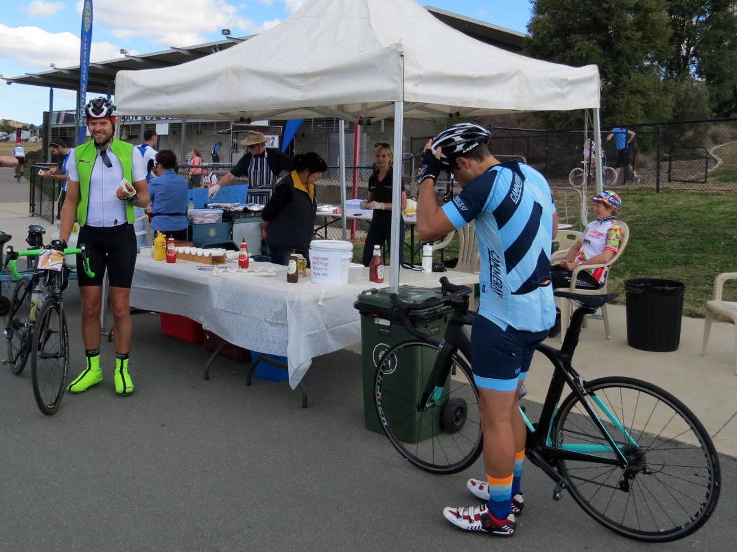
You get a free sausage sizzle on finishing -- and the adjacent Handlebar Cafe will be open.
Riders should be self-sufficient with regards to water and food, and use the refreshment stations to supplement what they are already carrying.